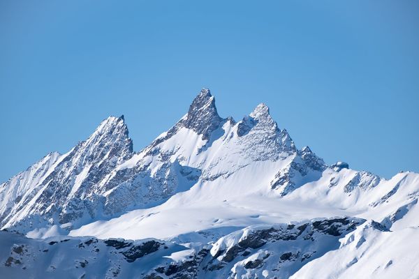
Where Were the Aiguilles Rouges 500 Million Years Ago?
A reconstruction of where the Aiguilles Rouges basement stood through five tectonic episodes, from the margin of Gondwana to Alpine exhumation. The Alps revealed this massif, but its deepest transformations are Variscan.
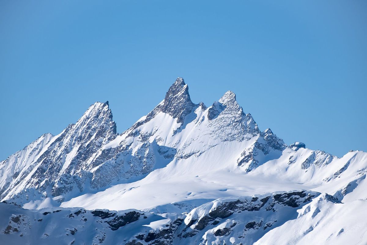
Five periods, five positions, and what each left in the rock
Companion article to "Five vanished oceans". Same clock, a single massif: the Aiguilles Rouges basement, opposite Chamonix.
The Aiguilles Rouges are not an Alpine mountain. The basement that makes them up is a fragment of the old Variscan network, planed down, buried, then brought back up like an elevator sixty million years later. The Alps made nothing here. They exhumed.
What remains is to determine where this rock stood at each turn of the ride, and what each turn did to it. Here is its journey, in five acts.
The journey on one page
| Period | Where | What happens | Depth |
|---|---|---|---|
|
-
Before
> 2.5 Ga
|
Do not yet exist | Tiny, nearly indestructible crystals form within a very ancient continent | - |
|
I
Margin of Gondwana
600 → 420 Ma
|
Northern Gondwanan margin temperate to tropical latitudes |
Marine platform: sands, muds. Then tearing and volcanism | 0 to a few km |
|
II
Crossing
420 → 350 Ma
|
Carried on a fragment of continent drifting northward | The fragment detaches at 370 Ma, crosses an ocean, collides around 350 | moderate depth |
|
II
Burial
~337 Ma
|
Buried beneath the mountain chain under construction | Deep transformation (eclogite). The massif's only truly deep episode | 61 km, 700 C |
|
II
Ascent
337 → 300 Ma
|
Rise along major faults | Partial melting, partly molten rocks, granites, mineralization | 61 → 15 km |
|
III
Pangaea
300 → 200 Ma
|
Heart of Pangaea beneath the equator |
Nothing. Erosion down to a peneplain | passive rise |
|
IV
European margin
200 → 66 Ma
|
Passive European margin | Subsidence, burial beneath the cover | burial |
|
V
Alpine elevator
66 → 0 Ma
|
Beneath the Alpine nappes, then in a window | Moderate reburial, then exhumation | 10 km → 0 |
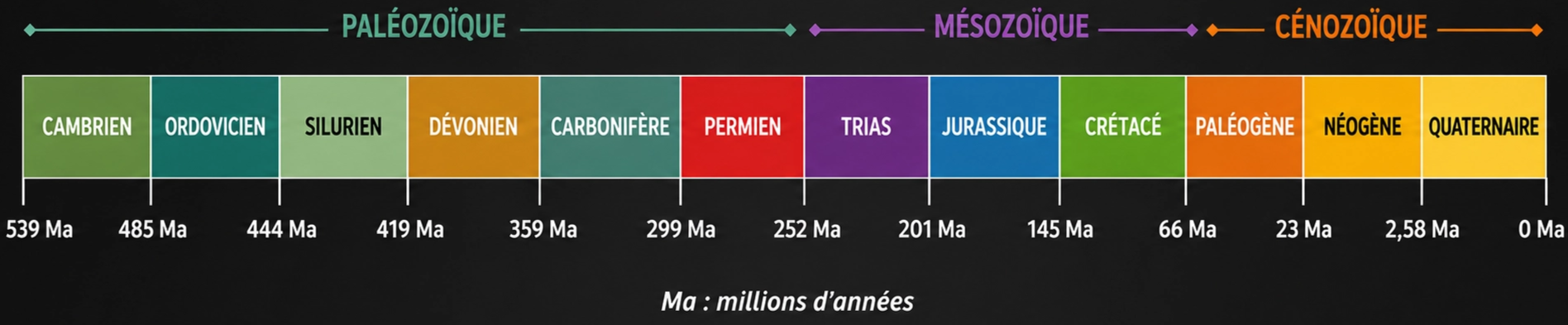
Before Period I: material already old
Even before the story begins, there is the raw material. On a very ancient continent, long before any of this existed, microscopic crystals formed in magma as it solidified. These are zircons, a tiny, nearly indestructible mineral that survives erosion, transport, burial, and even the partial melting of the rock that contains it.
That is why they can still be found intact in today's Alpine basement: the ages measured in them are 1.0, 1.7, 2.0, and up to 3.17 billion years, derived from the West African craton. Three billion one hundred and seventy million years. The raw material of the Aiguilles Rouges is therefore recycled continental matter, torn from a hinterland that no longer exists in that form, and it is on this foundation that everything else was built.
Period I - 600 to 420 Ma: a beach on the margin of Gondwana
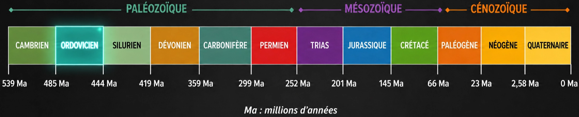
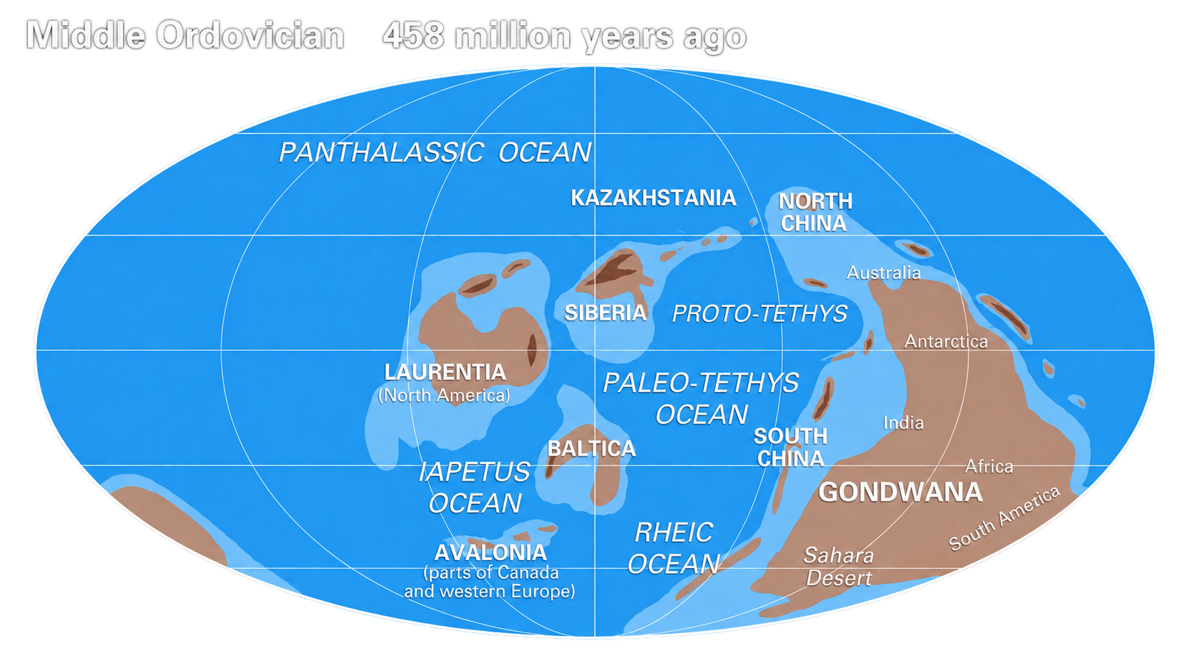
The story begins on the northern margin of Gondwana, at temperate to tropical latitudes, not polar ones. A continental margin is the edge of a continent: the part that slopes gently beneath a shallow sea before meeting the ocean floor, rather like the east coast of the United States today. And on the most exposed part of this margin, the future massif lay on the plate that overrode an active zone where another plate was descending southward, directly above that descending slab. An unstable position rather than a quiet one, and the one that would trigger, a few tens of millions of years later, the tearing and volcanism that then appeared.
For the moment, nothing hinted at it. A shallow sea settled in: sands, muds, sediments receiving debris from the old continent, zircons included. Quiet nearshore sedimentation for a hundred million years.
Then the margin tore apart from behind. An oceanic ridge, a zone where new oceanic crust normally forms, was swallowed by the subduction zone and driven downward; there it injected heat from below, while the rear of the system thinned. The crust stretched, volcanism of many kinds began, and lavas spread across the seafloor. A chain of volcanoes was probably built in the region, much like those found today above active subduction zones, the Andes or Japan.
It was in this sea, and then in this volcanic zone, that all the material of the massif was assembled: sediments transformed by heat and pressure, rocks produced by volcanism, and deeper rocks dated between 450 and 475 million years. The important point for what follows is that their chemical composition shows that they came from the continent itself, not from the floor of an ocean. The massif is made of its own recycled material, not of oceanic crust imported from elsewhere.
But at this stage, nothing had yet gone deep.
Period II - 420 to 300 Ma: the journey, the depths, and the furnace
This is the period that matters. Everything visible today in these walls was made here.
Departure

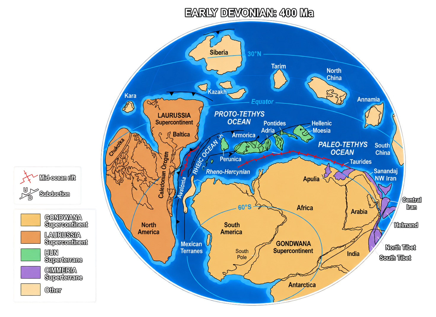
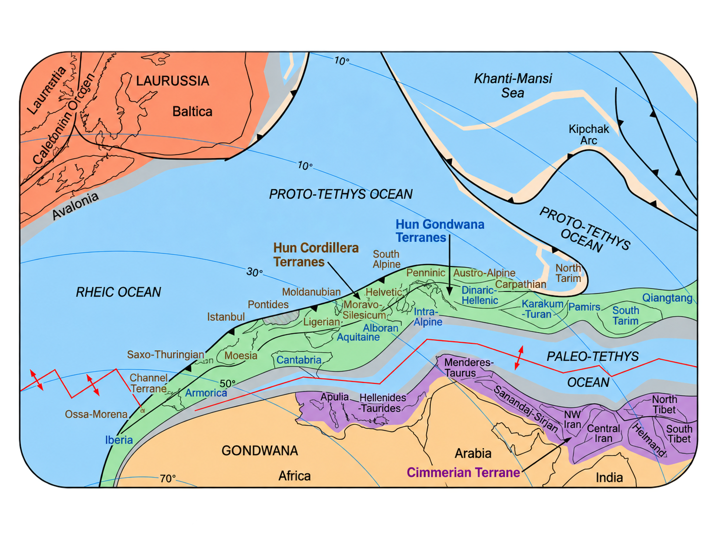
After one hundred and eighty million years of quiet life on the margin, everything changed. From 370 Ma onward, the massif was carried on a long continental fragment that detached from the margin of Gondwana and drifted northward. Geologists have given this fragment a name, the Hun ribbon: among other things, it includes the basement of the External Alps, and therefore our massif.
The driving force was not a push but a rollback. The oceanic plate descending beneath it aged, grew heavier, and retreated, pulling the margin behind it. The crust stretched, tore apart, and a long continental ribbon set out across the ocean.
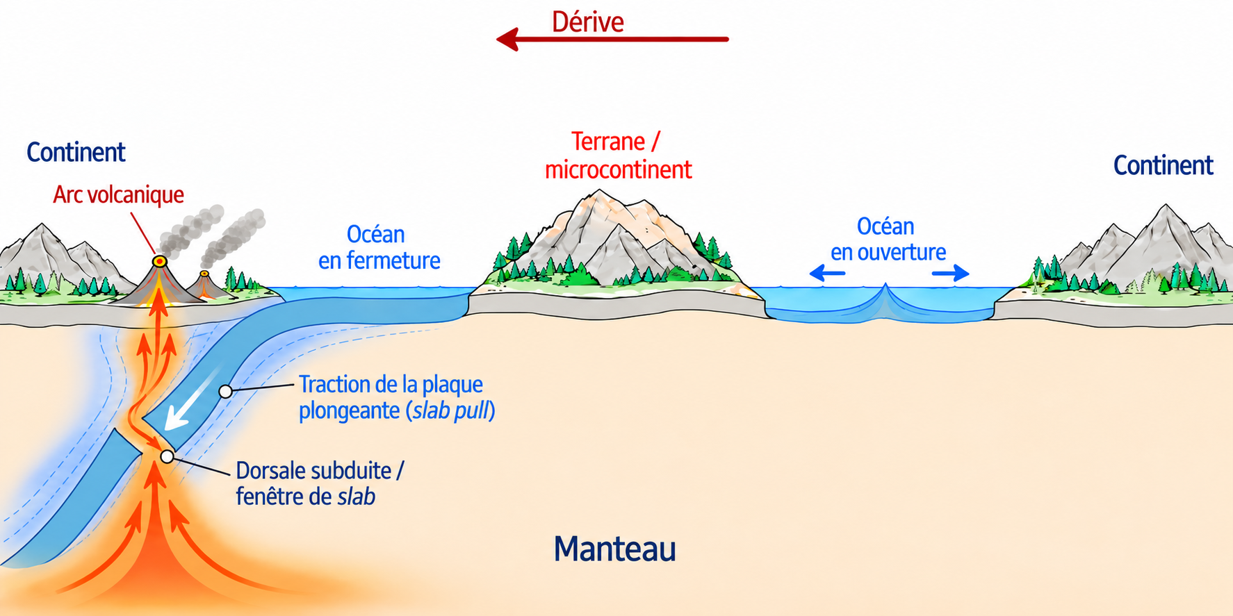
Toward what? Toward a continent formed farther north by the welding together of North America and Baltica, Laurussia, the landmass that would later bear northern Europe. It was the only shore facing them. In front of the ribbon, the ocean separating them closed progressively as it advanced; behind it, in the space it left behind, a new ocean opened.
And this ribbon did not land on an empty shore. Laurussia too lost a piece of its own margin, which detached at the same time and set out to meet it. Two ribbons therefore advanced toward each other. It was this second piece, coming from the north, that the Aiguilles Rouges basement collided with, a fragment that would not retain an identity of its own, because it too would be dissolved into the general stack when everything closed again.
But one important detail must be kept in mind: the massif did not pass beneath the margin of the northern continent. It remained above, on the overriding side, not on the descending side, exactly as in the previous period. During this journey the direction of subduction even reversed twice, around 380 and then 340 Ma: the oceanic plate descending one way stopped, broke off, and another plate, on the other side of the contact zone, took over and in turn descended in the opposite direction. Each time, it was the oceanic plate that changed sides, never the continental fragment carrying the massif. That fragment always remained seated on the upper plate, the one that did not descend. As a result, none of these reversals drove it into the depths.
What matters is that everything happened during this long journey, not at the moment of arrival. Remaining "on top" during its own collision did not mean remaining on top forever. That collision, around 350 Ma, was only one episode among others: the complete merger of the two large continents came only fifty million years later, and before then other blocks were still added to the stack, above what had already been piled up. The massif, which dominated its own collision, thus ended up progressively buried beneath everything that accumulated after it, not because it changed sides, but simply because the pile kept growing above its head. This progressive stacking, and it alone, explains the sixty-one kilometres of depth that we discover later, not a subduction beneath Laurussia, which would come only afterward: attachment to Laurussia did not occur until around 320 Ma, nearly twenty million years after that burial.
The journey can be summarized by a few markers: the fragment began to form around 400 Ma, the direction of subduction reversed around 380, it set adrift from 370 onward, entered collision with the other fragment around 350, and a mountain chain was built at 340. That chain then attached to Laurussia around 320 Ma, and the final collision between the two large continents, Gondwana and Laurussia, did not occur until 300 Ma. Remember those last two dates: they rule out an explanation that circulated for a long time, that of a massif crushed "like a sandwich" between the two whole continents. That sandwich did not close until forty million years after the burial it was supposed to explain, far too late to be the cause. This is a view that has changed within the discipline since the 1990s, and some details remain debated.
The descent: 337 Ma, sixty-one kilometres
The journey then came to an abrupt stop. The massif was buried beneath the Variscan chain under construction, and today the exact conditions of that burial can be measured: about 700 C, at 337.5 +/- 2.5 million years. That is sixty-one kilometres of depth, enough to transform the rock into eclogite, a dense rock that forms only at that kind of depth.
And it was not the northern continent that crushed it. At 337 Ma, the fragment was not yet attached to it: that attachment came a little less than twenty million years later, and the impact between the two large continents nearly forty million years later. What buried the massif was the meeting of the two fragments: the piece that came from Gondwana collided obliquely with the one that came from the north. The mountain chain they built thickened, and the basement passed beneath it. The massif was caught within that stack, not between two whole continents. It was a collision between two pieces, not a collision between two worlds.
This was not a local accident. Three other Alpine massifs of the same type, Pelvoux, Belledonne, and Argentera, yield very similar ages, around 337 to 340 million years: the peaks of this episode are contemporaneous, within the margin of error. Contemporaneous, not identical, Belledonne is shallower than the point measured here, but it was indeed a common episode across the whole chain, not an isolated curiosity.
This age of 337 million years is not a coincidence peculiar to this massif: it turns up elsewhere, measured in a completely different way. At the far southern end of the Alpine chain, the Dolomites region was folded and broken by the building of the Alps, but never reheated by them: the collision pushed it, without baking it. Its rocks therefore never had the chance to reset their internal clocks to zero, and they yield 330 to 340 million years, without exception: the same age, found hundreds of kilometres away, by a different method, on different rocks. Two independent measurements, a single figure. This is not a laboratory accident, but a real event shared by the whole chain.
The question of mechanism remains, and is still debated. One possibility is an oblique collision, with strong lateral slip between the two blocks, compressing continental crust that was already warm: the measured heating rate, about 11 C per kilometre of depth gained, matches that kind of episode well.
A second possibility, more brutal, is that the descending plate did not slide cleanly beneath the other. Instead it scraped it, tearing whole blocks from its base, some the size of a French department, and dragged them downward with it. A comparable massif in the Italian Alps bears the mark of this: old continental granites, which are nothing like oceanic crust, nevertheless show every sign of a plunge to very great depth.
Both possibilities remain open, and the researchers themselves do not decide between them.
Whatever the exact mechanism, what this plunge left behind is the eclogite still found today, a rock that the ascent partially transformed as it cooled, but which retains the trace of its passage through sixty kilometres of depth. It is the only witness, in this massif, to such a stay in the deep crust.
The ascent: the furnace, the granites, the gold
Then it rose, and here is why: the mountain chain that had just formed had become too thick and too hot at depth, and it collapsed under its own weight. It spread like dough that had become too soft, thinned, and hot mantle rock, at more than a thousand degrees, rose to fill the void. The crust was then no longer baked from above but heated from below, a great deal of heat, almost no additional pressure. This is the signature found throughout the Alps at that time: granites forming after the building of the chain, and magma veins cutting across everything else. Deep rock was thus brought back toward the surface along major faults, within a crust that was still warm. It therefore did not cool as it rose: it decompressed while still hot, and that is what triggered everything that followed.
First, as it rose a little, the rock began to transform: the ascent was under way. Around 320 million years, temperature and pressure reached a new peak: some rocks, of favourable composition, melted in place as a result of pressure decrease. Three million years later, around 317 million years, deep rock began to melt along major faults: it became partly liquid and behaved like modelling clay. Quartz crystals stretched into pancakes, and those are the bands visible today in the gneisses. At 307 million years, the granites of Vallorcine and Montenvers rose into openings created by two faults slipping in opposite directions. And at 304 million years, the Mont Blanc granite, the youngest intrusion, rose into the same kind of opening: the summit of western Europe is magma that rose into a fissure opened by two faults.
The most visible legacy of this episode can be read in the mining landscape. As these granites cooled, they expelled huge quantities of very hot, pressurized water: it became extremely reactive and circulated almost like a gas. It percolated through faults, dissolved metals present in small quantities within the rock, loaded itself with silica and sulfur, then redeposited them suddenly as it rose. Gold, galena, sphalerite, the ores of lead and zinc. Looking at these walls, one is looking at the fossil plumbing of an immense geothermal system.
Let us change scale. While these granites were cooking at depth, the landscape at the surface was being dismantled just as quickly. Right beside the massif that was rising, a neighbouring basin, Salvan-Dorenaz, formed a depression that slowly sank and filled with debris stripped by erosion from the nearby relief, rather like a ditch deepening on one side while the earth removed from the other is thrown into it. It accumulated 1,700 metres of deposits in fifteen million years. Two rates are measured there, and their difference is the result: the basin floor subsided at about 0.2 millimetre per year, while the relief feeding it rose at about 1 millimetre per year. The depression formed five times more slowly than it was filled. In other words, erosion removed most of what was rising, and the basin trapped only a fraction of it. For fifteen million years, the massif was a landscape being shaved down as fast as it rose.
It is this pair of processes that brought the deep rocks beneath our feet, but each played its part: the major faults carried the basement from sixty-one kilometres up to about fifteen, and erosion took care of the last fifteen kilometres.
Around 300 Ma, the factory shut down. Everything that followed, including the Alps, was nothing more than transport and uplift.
Period III - 300 to 200 Ma: nothing, and that matters

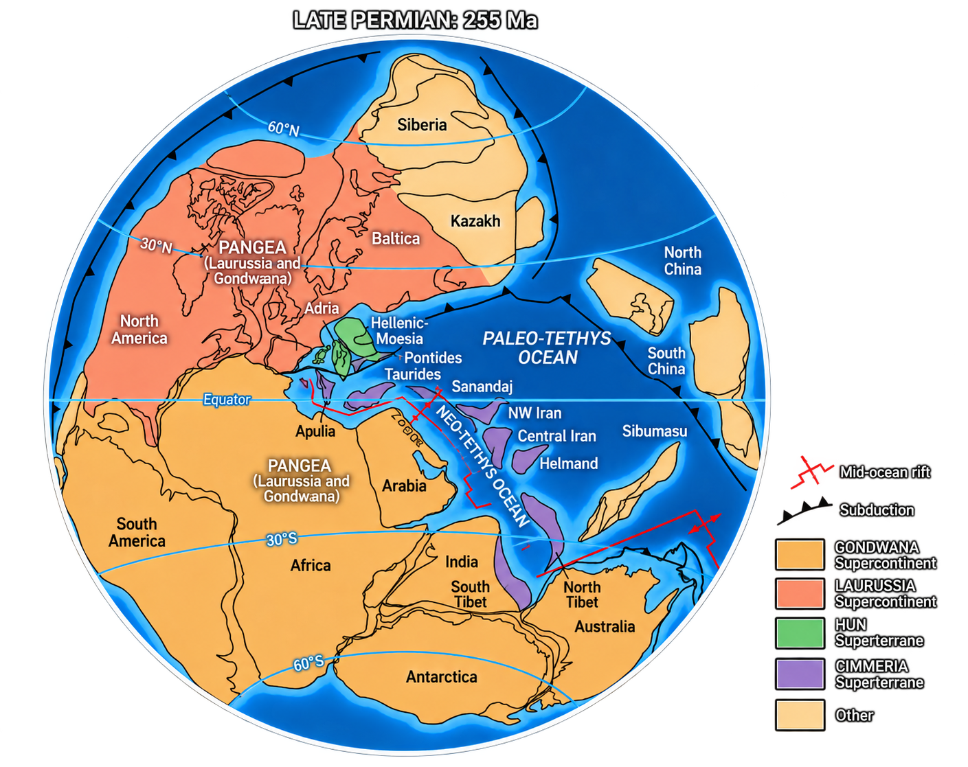
With the factory extinguished, the massif found itself at the heart of a single supercontinent, Pangaea, beneath equatorial latitudes, thousands of kilometres from any active zone. Mountain building had ceased. The end of the factory still lingered for a little while, the neighbouring basin went on filling for a few million years more, other basins opened along inherited faults, and some volcanism accompanied it all, but these were the last convulsions of a system shutting down, not a new episode.
After that, the tectonic machine was running at full speed elsewhere on the planet, oceans closing, others opening, whole continents shifting, and here the only activity was erosion. The basement rose toward the surface not because it was pushed, but because what covered it was being removed. In the end, all that remained was a worn plain cut down to the root, carved into rocks that had stood, one hundred and thirty million years earlier, at sixty kilometres of depth.
And that is decisive for what followed. When the Alps arrived, they did not encounter a soft crust. They encountered a basement already dry, already recrystallized, already melted once. A rock that has lost its water and crystallized its granites no longer folds like dough: it breaks into blocks and can be lifted as a block. That is the whole reason why the Alpine episode was an elevator rather than a kneading.
Period IV - 200 to 66 Ma: basement of a passive margin

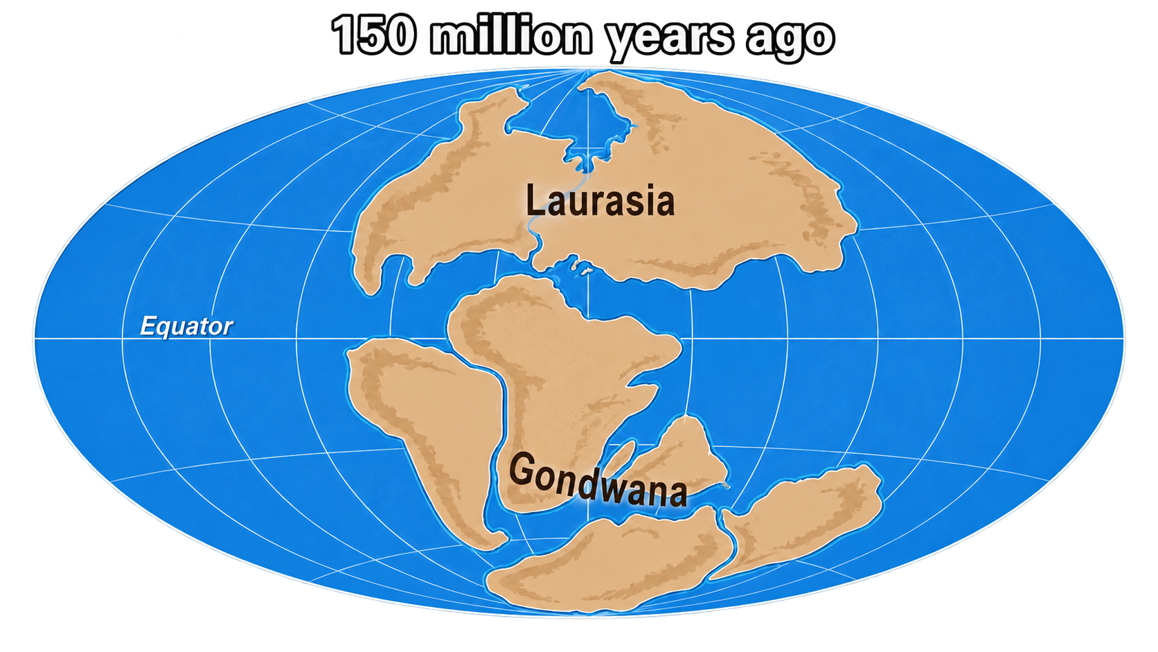
Pangaea broke apart, and a new sea opened: the Alpine Tethys. The massif remained on the European side; the tear passed farther to the southeast. Its role then changed: from a wandering fragment, it became stable basement at the edge of a continent. The crust stretched, old faults were reactivated, the basement subsided gently and allowed itself to be buried beneath a thick cover of sediments.
This long burial left two things. The first was protection: without this sedimentary lid, the erosion that had already planed the massif down in Period III would have continued its work and would eventually have attacked the deep rocks themselves, those that preserve the memory of burial, the furnace, and the granites. Buried beneath its cover, the rock was kept safe, intact, waiting for the Alps one day to reveal it. The second was a template: the network of faults that Alpine mountain building would later reuse, in reverse, was already in place. They are the very same faults inherited from the previous ascent. Three successive mountain-building episodes used the same structural drawing.
Period V - 66 to 0 Ma: the elevator

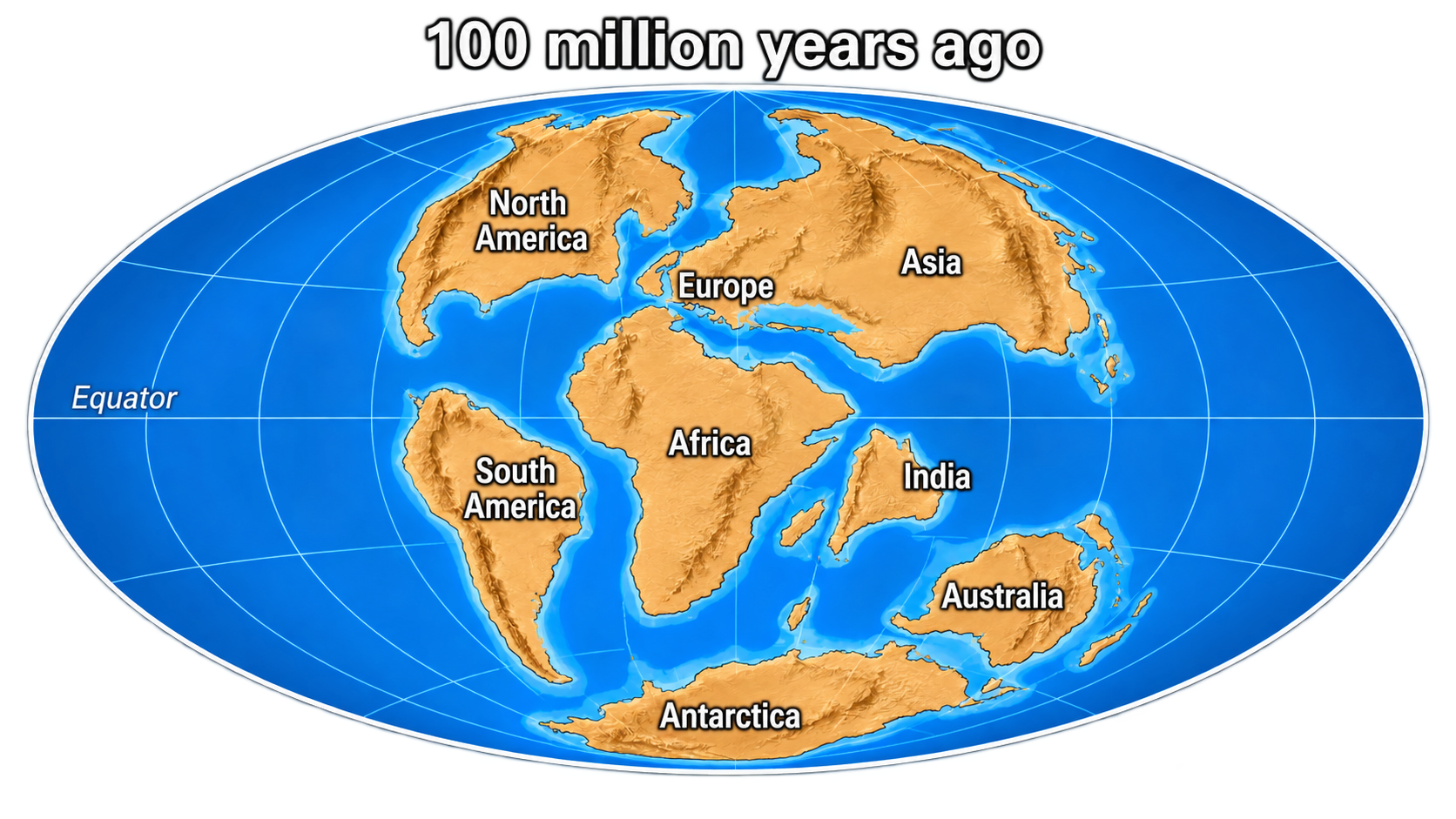
One hundred and thirty million years later, everything tipped. The Alpine Tethys closed, the two continents framing it drew together, and great sheets of rock thrust in from farther south came to cover the massif: the basement of the Aiguilles Rouges first found itself buried beneath this stack of Alpine nappes under construction. Then erosion opened a hole through that cover at exactly this spot: a window, a place where the old basement reappears at the surface through the younger nappes that had temporarily hidden it. It was reburied, but only moderately: 300 to 400 C, around ten kilometres.
And one must understand why it was so little. The massif belonged to the old stable margin of the European continent, the edge that never descended. For tens of millions of years, the Alpine ocean sank far away, beneath the other continent, and this margin watched from a distance. It entered the collision only at the very end, when the ocean had vanished and the two continents truly collided: it was battered, fractured, and uplifted, but not dragged down into the depths. It was the bumper, not the engine.
Massifs of this type therefore escaped the worst of what the Alps can do. That is precisely why their ancient past is still legible, whereas it becomes illegible in massifs closer to the centre of the collision, where the same rocks descended to 50, 60, sometimes 100 kilometres during the Alpine episode. Our massif did not melt and did not fold: because its rock had already been dry and brittle since Period III, it absorbed shortening by breaking into blocks that rode over one another, rather like a stack of books pushed from the side. It is this block faulting, rather than folding, that shortened the massif by about 30 percent. The minerals filling the fractures opened by these breaks formed around 400 C.
Then it rose. One mineral from the massif allows this rise to be dated precisely: it records the moment when the rock passed back below about 110 C, which happened 15 to 20 million years ago. The crystals found in the fractures, the ones sought by mineral collectors, formed between 18 and 8.5 million years ago. That is the clock of uplift.
What this final turn left behind is the landscape: a window where one can walk on rocks more than three hundred million years old, opposite Mont Blanc, and touch rocks that made the entire journey.
What the journey tells us
The Alps are not the event, they are the final chapter. The real chemical and tectonic factory, the one that transformed marginal mud into eclogite and then into gold-bearing granite, shut down three hundred million years ago. That does not make the Alpine episode negligible: without it, this basement would still lie buried beneath kilometres of sediments and nobody would know it was there. But it made nothing here.
The massif is not a special case. What people climb opposite Chamonix belongs to the same great family of continental fragments as the core of the Bohemian Massif, six hundred kilometres to the east-northeast. Same fragment detached from Gondwana, same crossing. What followed separated them, the stacking of blocks, then the Alps redistributed the pieces, but the point of departure was shared.
And this kinship can be demonstrated twice, by two independent paths. The first is to reconstruct, step by step, the trajectory of each continental fragment: that places them side by side at the outset.
The second requires no reconstruction at all. One only has to compare the thermal histories. Rocks swallowed in the Alps recorded exactly the same three-stage sequence, at the same periods, as old massifs that remained away from the Alpine collision, farther north. Two methods with nothing in common converge on the same conclusion: beneath the Alpine disorder, the foundations of Europe share one and the same ancient origin. The Alps severed the physical link between these regions; the heat recorded in the rock stitches it back together.
And the permanence of the mountain is a complete illusion. These rocks have been beach, volcano, deep rock sixty kilometres down, magma, granite, worn plain, stable basement, and finally summit. In two or three hundred million years, the Alps in turn will be planed down and these same rocks will end as sand in an ocean that does not yet exist. Perhaps geologists of the future will use these same zircons to recover the trace of a very old forgotten Alpine world.
The zircon will have watched both worlds pass without flinching.